
India's NDMA to Study Nepal Flash Flood Triggered by Hanging Glacier Collapse

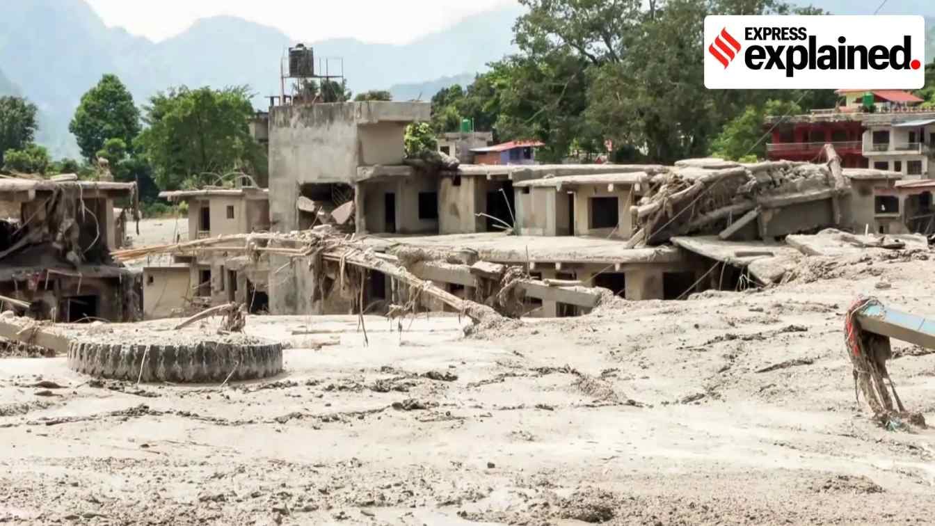
The recent devastating flash flood in Nepal, likely triggered by the collapse of a hanging glacier, has drawn close monitoring from India's disaster management authorities. In response to the event, the National Disaster Management Authority (NDMA) has announced plans to initiate a comprehensive study of the incident to better understand and mitigate similar risks in India.
India has experienced several major flash flood disasters in its Himalayan regions in recent years. These include the Kedarnath tragedy in 2013, the Chamoli disaster in 2021, the Sikkim glacial lake outburst in 2023, and a flash flood in Dharali last year. These incidents resulted in hundreds of fatalities and caused widespread destruction of infrastructure.
NDMA to Study Nepal Disaster
According to the NDMA, many mountainous areas in India share a similar vulnerability to the glacial hazards observed in Nepal. The authority aims to analyze the Nepalese event in detail to strengthen India's own disaster preparedness and response strategies.
"Many areas in India are vulnerable to the kind of disaster we have just seen in Nepal. We have had such events in the past. So it is important for us to study this, and understand this. We do plan to look at it in detail," said Krishna Swaroop Vatsa, Member of the NDMA.
Following the Chamoli disaster in 2021, the NDMA initiated targeted efforts to mitigate risks associated with vulnerable glacial lakes. This led to the establishment of the National GLOF (Glacial Lake Outburst Flood) Risk Management Programme, which focuses on installing early warning systems and strengthening lake boundaries.
National GLOF Risk Management Programme
The National GLOF Risk Management Programme is currently active across four hilly Indian states: Arunachal Pradesh, Sikkim, Uttarakhand, and Himachal Pradesh. The initiative also extends its coverage to the Union Territories of Jammu and Kashmir and Ladakh.
The urgency of the programme is highlighted by data released by the Indian Space Research Organisation (ISRO) in April 2024. ISRO reported that out of 2,431 glacial lakes larger than 10 hectares in the Indian Himalayan River basins, 676 lakes had expanded significantly between 1984 and 2023.
"This programme is progressing well. It will take some time, but this will help in significantly reducing the risks from glacial outbursts. The Nepal incident just reinforces the importance of this programme," Vatsa stated. He added that simultaneous efforts to develop landslide forecasting capabilities and early warning systems are also crucial, with experimental forecasts already underway in some areas.
Scientific Analysis of the Glacier Collapse
While scientists continue to investigate the precise trigger of the Nepal flood, glaciologist Anil Kulkarni from the Indian Institute of Science (IISc) identified the collapse of a large mass of rock and ice from a hanging glacier as the most probable cause. Kulkarni compared the impact of the falling mass to a "high-intensity bomb blast."
Satellite imagery released by the National Remote Sensing Centre (NRSC) supported this assessment, showing before-and-after views of the affected area. The images revealed a visible collapse of glacier mass and a heavily swollen channel along the Bhote Koshi river.
"From various satellite images and evidence available as on Thursday, it can be said that a hanging glacier collapsed vertically with a drop of between 1.5-2 km into a deglaciated valley," Kulkarni explained. He noted that the steep drop of the heavy ice mass generated immense energy upon hitting the soft moraine and debris below, pulverizing the ice into smaller flakes and unleashing the flood.
Seismic Data and Revised Assessments
A preliminary satellite-based assessment by the NRSC suggested that an ice avalanche might have temporarily blocked the river, leading to a sudden release of impounded water and debris. However, Kulkarni noted that it remains difficult to confirm with absolute certainty whether a temporary blockage occurred before the breach.
Initial reports from the US Geological Survey (USGS) on Wednesday indicated a 4.4 magnitude earthquake in the area just before the flood, leading many to believe it was the primary trigger. However, the USGS revised its assessment on Thursday after analyzing long-period seismic waves.
The revised USGS analysis concluded that the seismic energy, measured at a magnitude of 5.2, was actually generated by the physical impact of the glacial collapse and subsequent debris flow rather than an earthquake. Kulkarni stated that this seismic activity clearly indicates the glacier collapse or ice avalanche took place on the morning of August 26.