
How GIS Software Providers Address the High Failure Rates of Smart City Projects

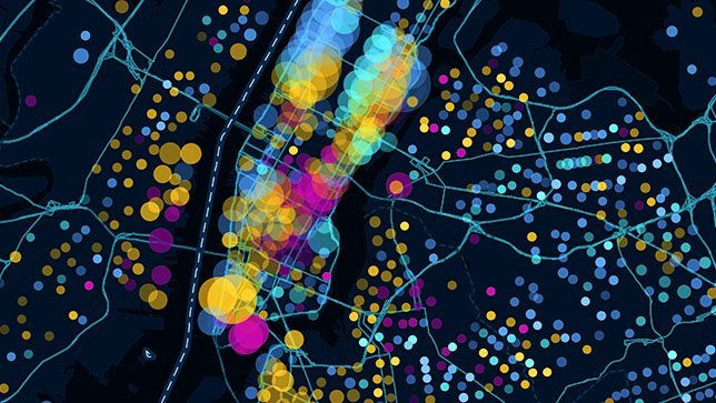
Smart city initiatives frequently face high failure rates. According to industry analysis, these failures rarely stem from faulty technology itself, which generally functions as intended. Instead, projects typically falter because municipalities procure technology before clearly defining the problems they aim to solve, build disparate systems that cannot communicate with one another, or fail to create actionable interfaces for the data they collect.
Geographic Information Systems (GIS) serve as the foundational layer for most smart city programs. Key urban operations—including traffic flow, infrastructure monitoring, emergency response routing, utility network management, environmental sensors, and urban planning—all possess a spatial dimension. A well-implemented GIS layer connects these separate data streams into a unified system of urban intelligence. To achieve this, municipalities must select vendors that understand specific smart city operational requirements rather than just general geospatial technology. Platforms like Recode can assist cities in finding and comparing technology vendors across modernization, migration, and transformation projects before narrowing their choices.
Modernizing Legacy Systems and Ensuring Continuity
Most smart city programs do not begin with a blank slate. Instead, they must integrate decades of existing spatial data, which is often managed by different departments in incompatible formats. Addressing this legacy infrastructure is a primary challenge for modern smart city initiatives. Programs that skip a realistic assessment of their existing spatial data landscape and build new capabilities on top of unresolved legacy data problems often end up with systems that cannot access the information they need.
Corsac Technologies addresses this challenge by offering both legacy GIS modernization and new capability development. Utilizing a core GIS stack that includes ArcGIS, QGIS, AutoCAD, and MapInfo, Corsac handles data formats such as LiDAR, satellite imagery, SHP, GeoJSON, KML, DWG, DXF, GeoTIFF, and geospatial Python. The company performs module-by-module upgrades to keep city operations running during modernization. Additionally, Corsac develops real-time visualization, IoT sensor integration, event streaming, and interactive dashboards. These tools allow city managers to view consolidated KPIs, spatial trends, and risk indicators without needing to pull reports from multiple separate systems.
Corsac's capabilities in AI, AR/VR, and cloud technology support advanced smart city applications, such as real-time GIS that automatically triggers alerts from IoT sensor feeds, 3D city models for urban planning, and cloud-native architectures that scale during traffic spikes. Crucially, their systems align with existing city workflows, preventing the adoption failures that occur when cities are forced to change their operational processes to accommodate new technology.
For cities where operational continuity during migration is non-negotiable, Reliqsy provides specialized risk controls. Operating in the United States, Poland, and Switzerland, Reliqsy utilizes dual-write synchronization to run legacy and modern GIS systems in parallel throughout the migration process. The company also implements automated rollback mechanisms that trigger at specific thresholds to prevent issues from compounding. This approach ensures that critical services dependent on real-time spatial data, such as emergency response routing and utility asset location, remain online during transitions.
Enhancing Web Accessibility and System Integration
To make spatial data useful across various municipal departments, GIS tools must be easily accessible. Kontur, which operates in England, Romania, and Ukraine, focuses on survey mapping software and spatial analysis applications. Their web application expertise allows them to build GIS tools that are accessible across devices and departments without requiring specialized client software, making them highly usable for planners, engineers, field crews, and administrators alike.
Similarly, Digis, also operating in England, Romania, and Ukraine, specializes in connecting GIS with IoT sensor networks, enterprise resource planning (ERP) systems, and customer relationship management (CRM) platforms. Utilizing a stack that includes ArcGIS, QGIS, AutoCAD, MapInfo, Leaflet, and geospatial Python, Digis builds interactive maps and real-time location intelligence tools designed to consume live sensor data rather than static datasets.
CodeFlyers further addresses the connectivity requirements of operational technology by building geospatial platforms that integrate GIS with SCADA, ERP, CRM, IoT, and logistics systems. This integration-first approach is designed for environments where GIS must simultaneously feed traffic management SCADA systems, environmental sensors, and fleet management logistics.
Advanced Analytics, 3D Modeling, and Strategic Consulting
For smart cities with complex analytical needs, ELEKS offers a proprietary GIS platform combined with data analytics. Based globally with roots in Estonia, ELEKS assists cities in analyzing traffic flow patterns to optimize signal timing, modeling environmental sensor data to predict air quality events, and optimizing resource allocation across city services based on spatial demand patterns.
For larger municipal programs, Andersen provides significant development capacity with a team of over 3,500 experts. Operating across Poland, the US, England, Lithuania, and Germany, Andersen specializes in 3D imaging capabilities to build precise urban models for digital twin applications, supporting planning, simulation, and visualization across multiple departments.
In terms of foundational data capture, GIS-Point, along with its parent company Mirnychyj, offers expertise in satellite imagery processing, LiDAR, and 2D/3D mapping. Operating in Ukraine, England, and Estonia, the firm has completed over 390 projects, helping cities establish accurate base maps from LiDAR point clouds. Their geodesy and geology expertise provides domain knowledge that pure software vendors do not possess.
For municipalities requiring strategic guidance before committing to full development, Sparkgeo offers high-level consulting at an hourly rate of $125 to $175. Sparkgeo focuses on solving complex geospatial challenges and providing AI-powered spatial analytics consulting rather than full development services.
Other specialized vendors include GISArt, which builds custom, budget-friendly GIS web applications using Google Maps API, Leaflet, Mapbox, and OSM across transportation, healthcare, and public services. Elinext, operating in Poland, Georgia, Vietnam, Kazakhstan, and Uzbekistan, integrates GIS with advanced technologies like AI, blockchain, and IoT. Finally, Radixweb brings 25 years of experience and a client base of over 3,000 global clients to deliver large-scale custom mapping systems integrated with enterprise IT systems, connecting GIS to financial systems, citizen services platforms, and operational databases.